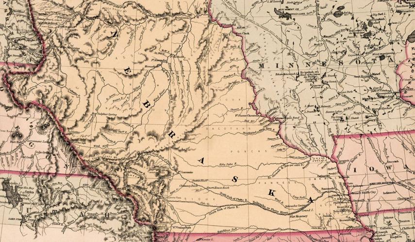
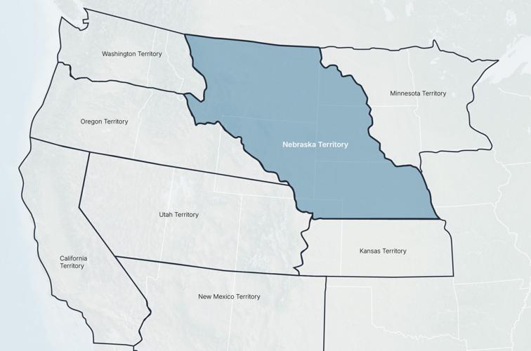
This circa 1855 map, made by the J.H. Colton mapmaking company of New York City, shows that Nebraska Territory covered part of present-day Colorado and most of present-day Wyoming, Montana and both Dakotas.
Nebraska State Historical Society
The Nebraska Territory wasn’t the only extra-large territory in the western U.S. during the mid-1850s. Only California, which became a state in 1850, still looks like it did then.
One morning after a night of one too many drinks, I gave in and passed my then 2-year-old daughter my phone to watch cartoons while I slept it off. When I woke up, Peppa Pig was nowhere to be found, but my kid had somehow managed to purchase a vintage Nebraska Territory maponline. Well played, eBay one-click Buy It Now.
kAmkDA2?m%96 AC6G:@FD ?:89E[ x 925 C233:E\9@=65 :?E@ E96 H@C=5 @7 }63C2D<2 J6DE6CJ62C — 2?5 x 5@?’E >62? E96 %@> ~D3@C?6 6C2] x H2D >2CG6=:?8 2E 9@H 3:8 }63C2D<2 FD65 E@ 36]k^DA2?mk^Am
This circa 1855 map, made by the J.H. Colton mapmaking company of New York City, shows that Nebraska Territory covered part of present-day Colorado and most of present-day Wyoming, Montana and both Dakotas.
The Nebraska Territory wasn’t the only extra-large territory in the western U.S. during the mid-1850s. Only California, which became a state in 1850, still looks like it did then.